
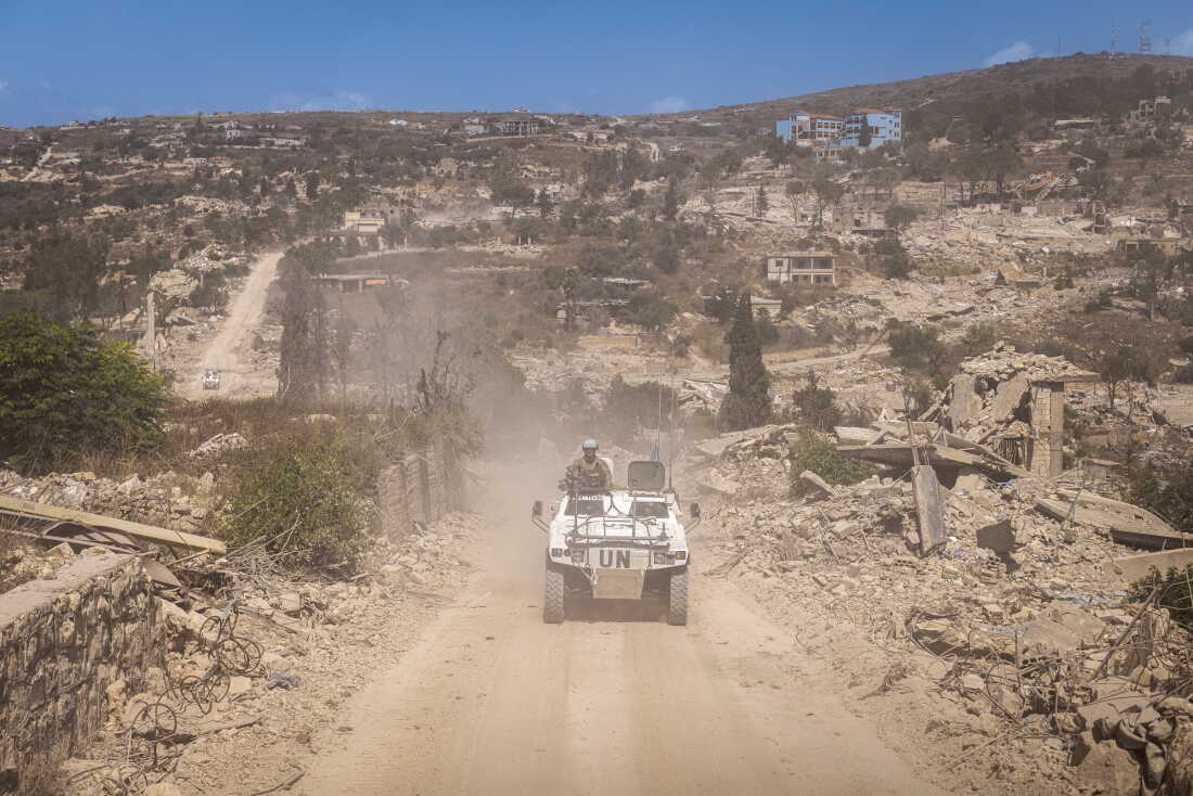
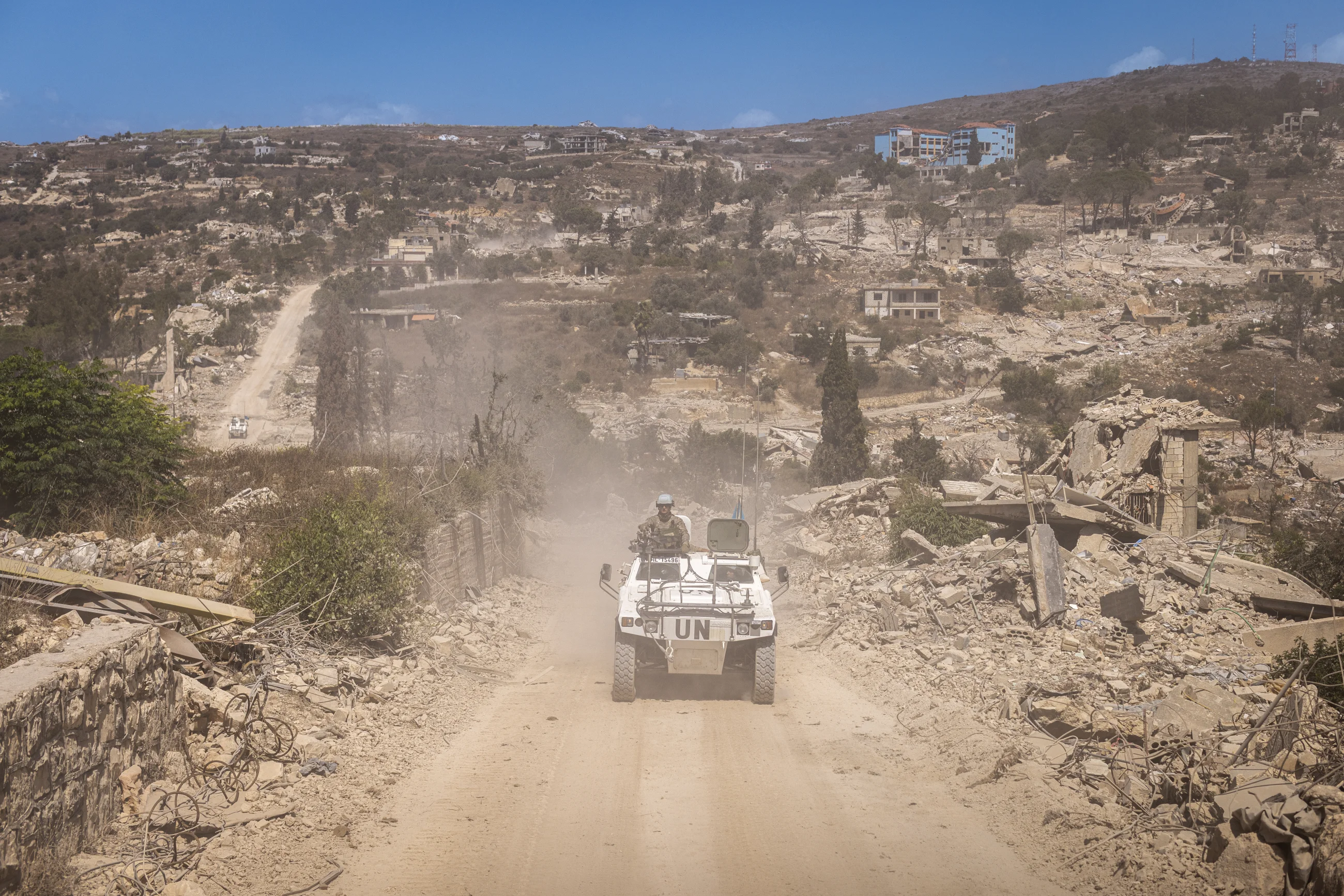
French UNIFIL peacekeepers patrol beyond the “yellow line” — the boundary of occupying Israeli forces — through the flattened towns of Houla, Kfar Kila, and Odaisseh. Israel has established a restricted buffer zone beyond that line after a U.S.-brokered ceasefire this year.
Diego Ibarra Sánchez for NPR
hide caption
toggle caption
Diego Ibarra Sánchez for NPR
The U.N. peacekeepers’ armored vehicle moves slowly along the de facto border in southern Lebanon, not because of the terrain or the threat of shelling and drones, but because every mile means relearning a landscape profoundly transformed by war.
UNIFIL — the United Nations Interim Force in Lebanon — has been monitoring this area since 1978, when it was created to verify Israel’s troop withdrawal after its first occupation of Lebanon.
The U.N. expanded UNIFIL’s mandate 20 years ago to include monitoring adherence to a ceasefire in fighting between Israel and Lebanon’s Iran-backed Hezbollah – the militant group created in 1982 to counter a second Israeli invasion.
Almost half a century later, the peacekeeping force’s mandate will expire at the end of the year and due to U.S. and Israeli opposition, will not be renewed. There is still no durable ceasefire.
An agreement in June between Israel and Lebanon has brought only a fragile pause to a conflict that the Lebanese government says has killed more than 4,300 people, displaced more than 1.2 million and redrawn the geography of southern Lebanon since it began in March, when Hezbollah fired rockets at Israel. Israel says 39 soldiers and a military contractor, plus two civilians, have been killed in Hezbollah attacks since then. Seven U.N. peacekeepers have also been killed since the war began this year, according to UNIFIL.
The “blue line” — now marked by blue metal barriers — was the demarcation line drawn up by the U.N. for another Israeli withdrawal in 2000, after 18 years of occupation in southern Lebanon. Now marked by blue plastic barriers, it has served as a de facto border between two countries which has never formally agreed on boundaries.
Today, it remains on the map, but no longer fully describes the reality on the ground.
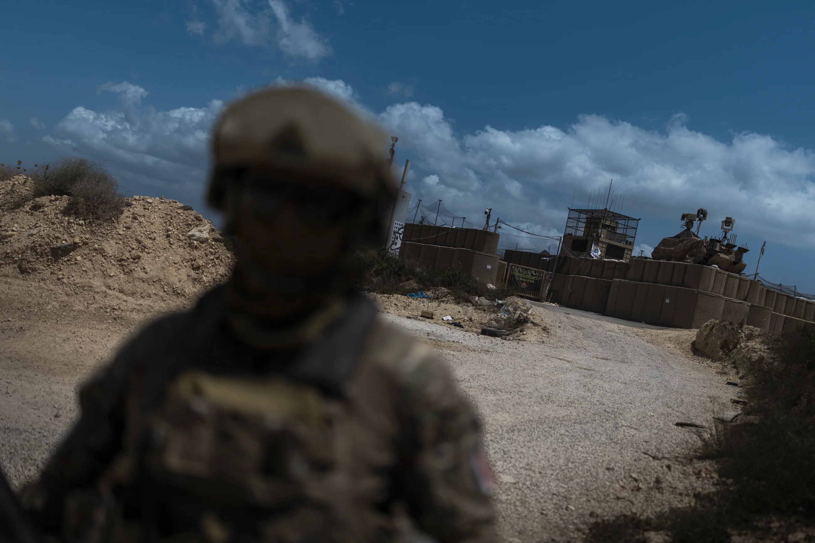
French UNIFIL peacekeepers patrol outside a military position taken over by the Israeli army. Israel has established a restricted buffer zone beyond the newly drawn “yellow line,” a boundary introduced shortly after the ceasefire. The area has revived memories of Israel’s 18-year occupation of southern Lebanon, which ended in 2000. Lebanese civilians are prohibited from entering the zone, which covers approximately 6% of the country’s territory.
Diego Ibarra Sánchez for NPR
hide caption
toggle caption
Diego Ibarra Sánchez for NPR

In Kfar Kila, Lebanon, a graffiti at the Fatima Gate has been crossed out. The landmark, located near the Lebanese village of Kfar Kila and Israel’s Metula, marks a former border crossing between Lebanon and Israel. Israel closed the crossing when its forces withdrew from southern Lebanon in 2000, ending an 18-year occupation.
Diego Ibarra Sánchez for NPR
hide caption
toggle caption
Diego Ibarra Sánchez for NPR

A view of Houla shows roads reduced to rough tracks, while homes have been destroyed and reduced to piles of concrete and rubble. Houla was the site of a massacre in 1948, shortly after the establishment of the state of Israel, in which Israeli forces killed dozens of Lebanese civilians.
Diego Ibarra Sánchez for NPR
hide caption
toggle caption
Diego Ibarra Sánchez for NPR

French UNIFIL peacekeepers patrol the “yellow line” through the flattened towns of Houla, Kfar Kila, and Odaisseh. Following U.S. and Israeli pressure at the U.N. Security Council, UNIFIL’s mandate ends this year after 48 years of monitoring ceasefires.
Diego Ibarra Sánchez for NPR
hide caption
toggle caption
Diego Ibarra Sánchez for NPR
Months of bombardment have blurred the old boundaries. New lines of control and restriction have emerged, changing how people move, work and return home. After months of restrictions, UNIFIL has reopened access to parts of its eastern sector that Israel’s military presence had placed off limits.
“Today, for the first time in several months, we are heading into the eastern sector. It is an opportunity for us,” says Sgt. Audric of the French UNIFIL battalion. French military policy in Lebanon prohibits identifying soldiers by first names for security reasons. “Since the negotiations began, we have been able to reopen this sector and finally regain our freedom of movement following the ceasefire.”
The reopening comes as the implementation of U.N. Security Council Resolution 1701, adopted in 2006 to end the war between Israel and Hezbollah and establish a security framework for southern Lebanon, faces renewed challenges. At the same time, UNIFIL, first deployed in 1978, could come to an end after nearly five decades. Its original mandate was to restore security, oversee Israel’s withdrawal and help re-establish Lebanese state authority in the south.
Yellow line

Spanish peacekeepers run a medical clinic in Mari, southern Lebanon, as part of a CIMIC (Civil-Military Cooperation) initiative that helps provide medical care for vulnerable local communities.
Diego Ibarra Sánchez for NPR
hide caption
toggle caption
Diego Ibarra Sánchez for NPR
Israel has established what it calls a buffer zone marked by what it refers to as the yellow line, a strip of land five miles wide in some places where Israeli forces continue to occupy Lebanon. It says the purpose of the zone is to prevent Hezbollah from firing rockets into northern Israel. Israel has barred Lebanese civilians from accessing their own land along the border and has demolished civilian homes and infrastructure in many of the border towns.
“The yellow line does not exist for us, but we have to mark it on the map so that we can visualize it,” says Lt. Col. Sebastián Dorado Santos, UNIFIL’s Spanish public information officer.
“It has disrupted normal life. Many civilians are unable to go to work or carry out their daily activities. The harvest season is approaching, but they cannot access their fields.”
Beyond the line, the physical scars of the conflict are visible everywhere. Roads have been reduced to rough tracks, marked by the passage of Israeli tanks. Houses that once sheltered families have been reduced to concrete and rubble. In some places, Israeli flags fly above the ruins.

A young Christian observes a Spanish UNIFIL battalion patrolling the streets of the Christian village of Ibel al-Saqi. UNIFIL has resumed street patrols following the escalation of hostilities in March 2026, which has killed more than 4,354 people across Lebanon, according to the Lebanese Health Ministry
Diego Ibarra Sánchez for NPR
hide caption
toggle caption
Diego Ibarra Sánchez for NPR

Spanish UNIFIL battalion patrols the Christian village of Ibel al-Saqi. The United Nations Interim Force in Lebanon (UNIFIL) is expected to conclude its operations on Dec. 31, 2026, marking the beginning of an orderly and phased withdrawal from Lebanon.
Diego Ibarra Sánchez for NPR
hide caption
toggle caption
Diego Ibarra Sánchez for NPR

A Lebanese girl speaks with a Spanish UNIFIL soldier as he patrols the streets of the Christian village of Ibel al-Saqi. Since September 2006, the Spanish Armed Forces have been deployed in Lebanon. Over the years, the Spanish contingent has carried out numerous civil-military cooperation (CIMIC) activities aimed at strengthening ties with local communities.
Diego Ibarra Sánchez for NPR
hide caption
toggle caption
Diego Ibarra Sánchez for NPR
A succession of emptied and flattened villages marks the route between the sectors: Houla, Odaisseh, Kafr Kila and the open structure of Fatima’s Gate, a former crossing between Israel and Lebanon closed by Israeli forces after they withdrew in 2000.
For local civilians, these are not abstract lines on a map. They separate homes from farmland, communities from workplaces and families from the places where they built their lives. The restricted area covers approximately 6% of Lebanon’s territory, reviving memories of Israel’s 18-year occupation of southern Lebanon, which ended in 2000.
Access remains largely prohibited, although just a few miles from the most heavily destroyed areas, some Christian villages remain inhabited, although isolated and with limited access to basic services.
Humanitarian convoys bring food, medicine and other essential supplies. Their presence, however, carries a symbolic weight.
“When they see us, they know they are not alone,” says Father Hani Tawk, coordinator of a network of Catholic organizations.
Many residents remain caught between a border they do not control, a limited state presence and an occupation with no clear end in sight, Tawk adds.
For local authorities, access to farm land is one of the most pressing concerns.
“Agriculture remains the main source of income and an essential driver of local development,” says Mari’s mayor, Salman Abou al-Ola. Farmers need to reach their fields and harvest their crops.”
The restrictions are also cutting communities off from basic services.
After months of suspension because of fighting, UNIFIL has resumed some of its non-military activities, providing basic medical assistance in areas where access remains severely restricted.
“There are no doctors here, and humanitarian assistance is insufficient. We are living like in a prison,” says Fayez Al Khaled, a Syrian resident of Ain al-Arab being treated by a visiting Spanish doctor.

Indian peacekeepers run a dental clinic in Mari, southern Lebanon, as part of a UNIFIL initiative providing humanitarian medical assistance to vulnerable local communities.
Diego Ibarra Sánchez for NPR
hide caption
toggle caption
Diego Ibarra Sánchez for NPR

Spanish peacekeepers deliver medical supplies to Mari in southern Lebanon, as part of a humanitarian initiative to strengthen humanitarian medical assistance for vulnerable local communities.
Diego Ibarra Sánchez for NPR
hide caption
toggle caption
Diego Ibarra Sánchez for NPR

A Spanish UNIFIL battalion patrols the Christian village of Ibel al-Saqi, southern Lebanon. UNIFIL has recently resumed patrols in areas of southern Lebanon that had been inaccessible during Israeli military operations.
Diego Ibarra Sánchez for NPR
hide caption
toggle caption
Diego Ibarra Sánchez for NPR
The main road to Nabatieh remains closed. When Khaled’s mother became ill, he says, there was no adequate medical care available.
“This area is characterized by a lack of employment opportunities and, more recently, intense fires,” says Maj. Jesús Fernández Manchado with the Spanish UNIFIL contingent. He says they suspended their activities in March and only recently resumed them.
The Lebanese government has accused Israel of deliberately setting wildfires in forested and agricultural areas to ensure villagers do not return. The Israeli military has refused to comment on the charges.
“The yellow line affects all our activities because it represents a new reality on the ground,” Manchado says. “For civilians, it means separating homes from their land. For us, it is neither recognized, marked, nor demarcated.”
But the yellow line is not the only development reshaping southern Lebanon’s border. A new system of “pilot zones” has also emerged — pinpointing areas where Israeli forces and Hezbollah fighters are meant to withdraw, with Lebanese armed forces replacing them.

Ihsan Yaghi stands inside her heavily damaged home. She was displaced to Beirut’s southern suburbs but returned to her village of Zawtar al-Gharbieh every day. She has six daughters, and her husband is retired.
Diego Ibarra Sánchez for NPR
hide caption
toggle caption
Diego Ibarra Sánchez for NPR
In the town of Zawtar al-Gharbieh, the consequences of that shifting geography are visible inside people’s homes. Ihsan Yaghi looks over what remains of her house on a visit from Beirut’s southern suburbs, where she has been displaced. Yaghi, who has six daughters and a retired husband, returned after hearing that Israeli forces had withdrawn from the village at the end of July. She waited for a week on it’s outskirts for clearance from the Lebanese Armed Forces before finally entering.

A Lebanese Armed Forces (LAF) soldier stands outside an armored vehicle at the “temporary checkpoint” separating the IDF positions from the area where Israeli forces have withdrawn, and local residents have begun returning to Zawtar al-Gharbieh.
Diego Ibarra Sánchez for NPR
hide caption
toggle caption
Diego Ibarra Sánchez for NPR

On July 22, 2026, a Lebanese Army soldier at the entrance to Zawtar al-Gharbieh, southern Lebanon. Lebanese residents forced to leave their homes months ago are now slowly returning to a devastated town without electricity or running water.
Diego Ibarra Sánchez for NPR
hide caption
toggle caption
Diego Ibarra Sánchez for NPR

On July 22, 2026, Lebanese Army soldiers monitor the entrance to Zawtar al-Gharbieh, where residents are cautiously returning after months of displacement. Following the conflict with Israel, the LAF has redeployed across southern Lebanon as part of efforts to restore state authority in areas long contested by Hezbollah under a U.S.-brokered trilateral framework with Israel and the United States.
Diego Ibarra Sánchez for NPR
hide caption
toggle caption
Diego Ibarra Sánchez for NPR
Inside the town, evidence of the occupation was still visible. A line of Israeli tanks stood positioned behind the houses.
Just a few meters away, another house had been used as a temporary shelter by Israeli soldiers. Cans, water containers, mattresses and crosses – seeming evidence of the home’s former Christian occupants — lay scattered across a dirty room. Drawings that included a Star of David covered the walls — apparent traces left by the soldiers who had stayed there.

On July 28, 2026, a Lebanese woman walks through a devastated landscape in Zawtar al-Gharbieh, southern Lebanon, following the withdrawal of Israeli forces. Lebanese residents were forced to leave their homes for months but are now slowly returning to their devastated town.
Diego Ibarra Sánchez for NPR
hide caption
toggle caption
Diego Ibarra Sánchez for NPR

In Zawtar al-Gharbieh, drawings cover the walls of the hallway of a home occupied by Israeli soldiers, with drawings covering the walls.
Diego Ibarra Sánchez for NPR
hide caption
toggle caption
Diego Ibarra Sánchez for NPR

Mahasen Fakih in her destroyed apartment. She returned to Zawtar al-Gharbieh recently after being displaced to the Chouf region, but there is still fighting nearby. “The explosions don’t stop throughout the night. I can barely sleep,” she said.
Diego Ibarra Sánchez for NPR
hide caption
toggle caption
Diego Ibarra Sánchez for NPR
Mahasen Fakih had been displaced to the Chouf region and returned to Zawtar a few days ago, and returned to find her home destroyed. There is still no electricity or running water in the town.
“The explosions don’t stop throughout the night, especially from Ali al-Taher. I can barely sleep,” she says, referring to a mountain landmark where Israel has been fighting to dislodge Hezbollah fighters.
Across southern Lebanon, thousands of people are trying to return to homes that no longer exist.

Mahasen Fakih stands outside her destroyed apartment in Zawtar al-Gharbiyah after returning to the village days earlier. The village is the first in a pilot project brokered by the U.S. for Israeli forces to withdraw and Lebanese forces to move in to secure the area.
Diego Ibarra Sánchez for NPR
hide caption
toggle caption
Diego Ibarra Sánchez for NPR
The blue line remains where it was drawn. But on the ground, a new geography has taken shape, marked by the constant hum of drones, restricted zones, abandoned villages, destroyed roads and fields their owners can no longer reach. Daily airstrikes are a reminder that, for those living here, the war is not over.
The map may still show the same border. On the ground, everything has changed.








Leave a Reply